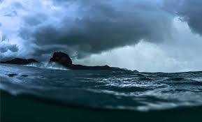
Scientists have uncovered a vast hidden landmass beneath the Pacific—larger than India and missing from maps for centuries. Nearly invisible and long dismissed, this discovery is rewriting Earth’s geological story and revealing secrets buried since the age of dinosaurs.

The idea that Earth has seven continents may need a serious update. In recent years, a large group of geologists has gathered enough evidence to support the recognition of an eighth. It’s called Zealandia, and it has been hiding in plain sight beneath the southwest Pacific Ocean.
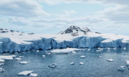
Covering nearly 1.9 million square miles, Zealandia is larger than India and two-thirds the size of Australia. Yet about 94 percent of it is submerged beneath the ocean. Only a few parts reach the surface, including New Zealand, New Caledonia, and several smaller islands.

Though the theory of a lost southern landmass goes back centuries, it wasn’t until 2017 that a scientific team published a detailed, peer-reviewed case identifying Zealandia as a continent. That publication in GSA Today, the journal of the Geological Society of America, outlined the full geological rationale for Zealandia’s status as Earth’s eighth continent.
________________________________________________________________________
What Makes Zealandia a Continent?
For decades, Zealandia was considered a fragment of continental crust, often referred to as a microcontinent. But advances in satellite gravity mapping, seafloor elevation data, and deep-sea drilling revealed a more complex and unified structure.
According to the Geological Society of America paper, Zealandia meets all four key criteria for continent classification. It has a distinct elevation relative to the ocean floor, contains a wide variety of continental rocks, sits on a thicker crust than oceanic plates, and has a well-defined geological structure.
Most oceanic crust measures about 7 kilometers thick. Zealandia’s crust averages 20 kilometers, typical of continental crust, though thinner than other continents. Its underwater terrain includes ridges, plateaus, and basins that together outline a continuous landmass.

The 2017 authors noted: “Zealandia is not just a collection of continental fragments. It is a coherent continent and should be recognized as such.” That statement, published in GSA Today, remains the strongest peer-reviewed argument for Zealandia’s continental status.
This redefinition was decades in the making. As far back as 1995, geophysicist Bruce Luyendyk proposed the name Zealandia for the submerged region, sparking new interest in its classification. But it wasn’t until technological advances made comprehensive mapping possible that the scientific case became undeniable.
From Gondwana to the Deep
Zealandia was once part of the ancient supercontinent Gondwana, which began breaking up over 100 million years ago. As Zealandia separated from what is now eastern Australia, it underwent extensive tectonic stretching. That geological strain caused the crust to thin, eventually sinking much of the landmass below sea level.
Some researchers estimate the continent began to submerge about 85 million years ago, and may have been fully submerged by 25 million years ago. Others argue that parts of it remained above sea level far longer.
In 2017, during an expedition aboard the JOIDES Resolution, an international team drilled more than 4,000 feet into the seabed at six sites across Zealandia. These deep cores revealed pollen, spores, and microfossils typically found in shallow marine or terrestrial environments—suggesting that parts of Zealandia were not always underwater. The BBC Future feature on Zealandia details how this expedition reshaped the continent’s profile.

Fossil evidence also supports this interpretation. In New Zealand and the Chatham Islands, bones from sauropods, ankylosaurs, and possibly even allosaur-like dinosaurs have been discovered. These species lived after Zealandia had broken away from Gondwana, implying that some sections remained habitable for millions of years.
A fascinating twist also comes from the discovery of a dinosaur-era foot bone on the Chatham Islands—highlighted in the same BBC investigation—raising questions about whether more fossils lie hidden under the seafloor of Zealandia.
________________________________________________________________________
Global Impact and Economic Stakes
The recognition of Zealandia as a continent has broad scientific and political implications. Under the United Nations Convention on the Law of the Sea (UNCLOS), countries can claim an extended continental shelf beyond their Exclusive Economic Zones if they demonstrate geological continuity.
New Zealand’s potential claim to an extended shelf is no small matter. If accepted, it could significantly expand the country’s exclusive economic zone, providing access to valuable marine mineral resources, seabed mining rights, and hydrocarbon reserves. Satellite data has already been used to map Zealandia’s extent, with clear elevation contrasts indicating its continental nature.
The broader scientific value is equally significant. Zealandia forces a reexamination of plate tectonics and continental drift, especially in cases where landmasses have been deformed or submerged. Its unique crustal properties also make it a case study in how continents evolve under pressure.
Geologists from GNS Science, including Nick Mortimer and Andy Tulloch, were instrumental in building the case for Zealandia. Their work builds on earlier theories first floated over a century ago. In fact, Sir James Hector, a 19th-century Scottish geologist, presented evidence in 1895 that New Zealand was the remnant of a submerged continental ridge. His insights were largely ignored at the time but are now viewed as early proof of Zealandia’s existence.
NOTE – This article was originally published in DAILY GALAXY and can be viewed here


